
Useful AI Tools — Satellite Analysis

Find any object in satellite imagery with AI
Useful AI Tools — Satellite Analysis – AI-driven object detection in satellite imagery
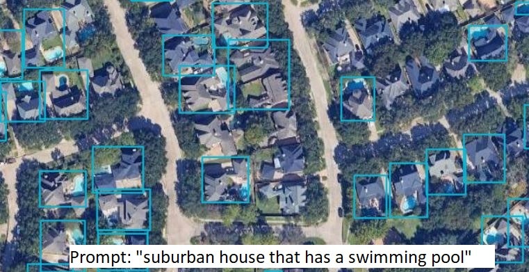
Summary: This tool uses Vision-Language Models to detect any object in satellite images by typing a prompt, bypassing traditional fixed-class models. It outputs bounding boxes projected onto geographic coordinates, enabling flexible, zero-shot detection of distinct structures and relational queries.
What it does
Users select a zoom level and enter a prompt; the AI analyzes each satellite map tile with a Vision-Language Model, generating bounding boxes that are mapped to real-world coordinates and displayed on the map.
Who it's for
Professionals in real estate, logistics, agriculture, and urban planning needing adaptable satellite object detection without retraining models.
Why it matters
It eliminates the need to train new models for each object class, enabling rapid, flexible detection across diverse satellite imagery tasks.