
Topomorph
3D Topo Terrain Visualization
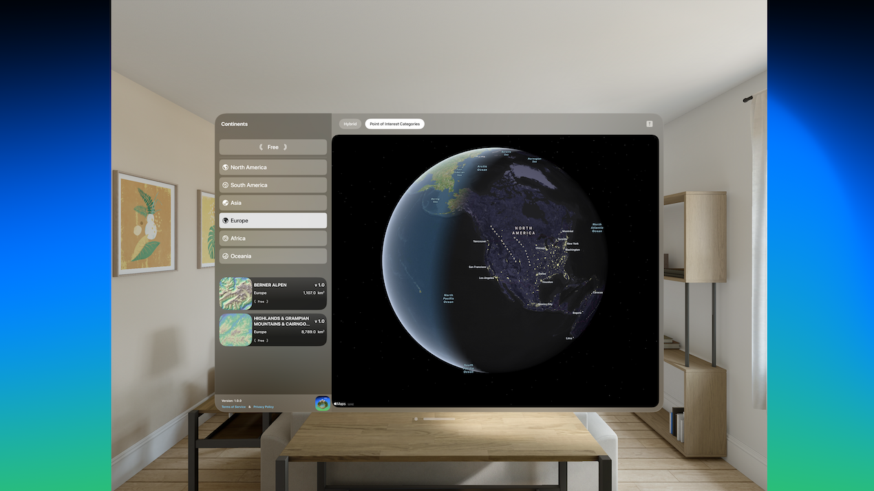
Topomorph – 3D Terrain Visualization for visionOS
Summary: Topomorph converts 2D topographic data into simulated 3D terrain models on Apple Vision Pro, enabling spatial visualization and analysis of Earth's geography with elevation-based coloring and interactive controls.
What it does
Topomorph renders flat elevation data into 3D terrain models using Apple Vision Pro’s spatial computing, applying color schemes based on elevation to differentiate geographic features. Users can interact with models through gestures to select, zoom, rotate, and position terrains within their environment.
Who it's for
The app is designed for geography enthusiasts, educators, researchers, 3D visualization professionals, and students interested in topographic data and terrain simulation.
Why it matters
It provides a spatial reference and analytical tool for exploring elevation data in three dimensions, enhancing understanding of geographic features beyond traditional 2D maps.