
SiteMarker

Design & Construction Reporting Software
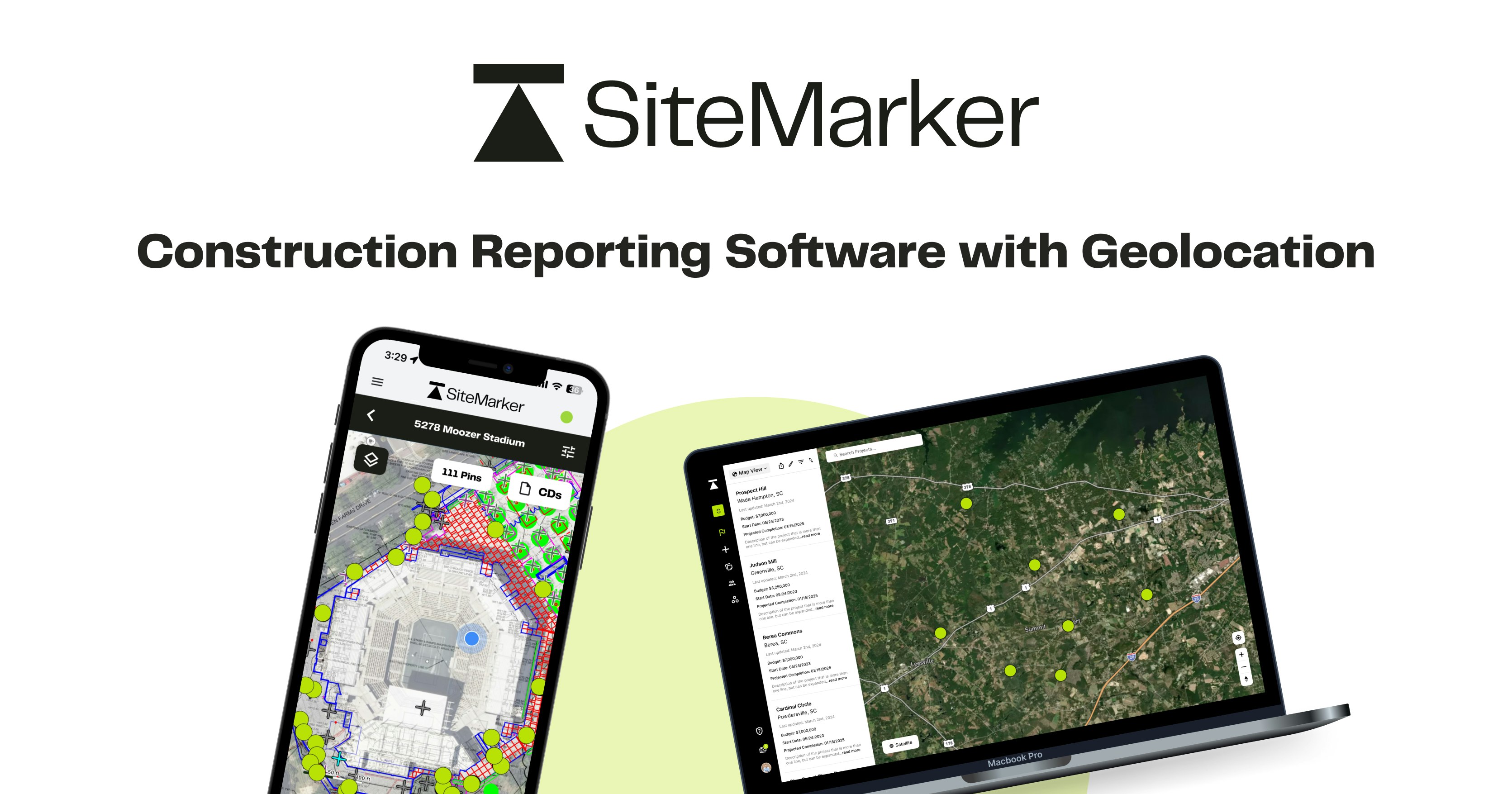
SiteMarker – Geo-located design and construction reporting
Summary: SiteMarker captures field data as geo-located pins containing time-stamped photos, notes, statuses, and categories, enabling spatially structured information from due diligence through project close-out. This approach allows instant generation of clear, shareable reports tied to exact locations.
What it does
SiteMarker organizes field information spatially by placing geo-located pins on maps, each holding contextual data to document and communicate site conditions throughout a project’s lifecycle.
Who it's for
It is designed for design and construction professionals needing to document and communicate field data linked to specific locations from early site work to project completion.
Why it matters
It solves the inefficiency of document-based workflows by consolidating all field data spatially, improving data capture, connection, and sharing across project phases.