
MyGPScamera

real-time GPS location, address, and notes to your photos
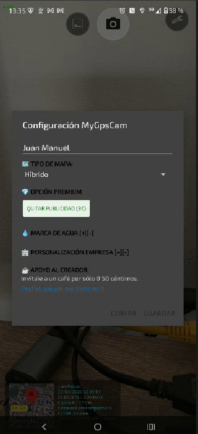
MyGPScamera – embeds real-time GPS data and notes onto photos
Summary: MyGPScamera automatically overlays precise GPS coordinates, altitude, map previews, and custom notes onto photos, providing exact location and contextual information. It integrates a gallery for managing geotagged images, aiding professionals and travelers in documenting photo details accurately.
What it does
The app captures photos with embedded latitude, longitude, address, and real-time map data, allowing users to customize displayed information and add personalized notes directly on images.
Who it's for
It is designed for professionals like civil engineers, real estate agents, field workers, and travelers needing precise visual location records.
Why it matters
It eliminates manual data entry by providing accurate, automatic geolocation and contextual details on photos for reliable documentation.