
GeoHeatMapper

Create geographic heat maps for free
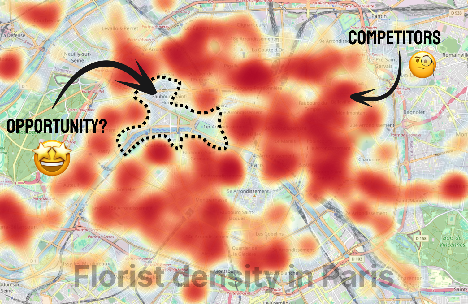
GeoHeatMapper – Generate geographic heatmaps from OpenStreetMap data
Summary: GeoHeatMapper creates heatmaps by extracting business location data from OpenStreetMap, enabling users to visualize competitor clusters and opportunity zones without GIS tools or data uploads. It provides instant, exportable maps for market analysis and decision-making.
What it does
It generates heatmaps based on selected business categories and locations using OpenStreetMap data, allowing users to identify competitor density and gaps. Maps can be exported for reports or presentations without requiring accounts or manual data input.
Who it's for
Founders, market analysts, consultants, local business owners, and sales professionals seeking visual market insights.
Why it matters
It simplifies market analysis by offering fast, free, and accessible visualization of competitor distribution and opportunity areas without complex GIS software or costly tools.