
GeoChat
LLM-powered geospatial intelligence for healthcare teams
GeoChat – LLM-powered geospatial intelligence for healthcare teams
Summary: GeoChat is an LLM-enabled GIS tool that provides natural-language answers directly on maps, integrating population health and access data for healthcare teams. It enables faster, decision-ready insights by allowing users to upload custom data and create maps without GIS training.
What it does
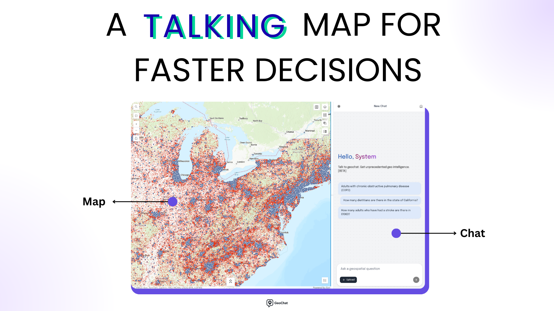
GeoChat lets users ask natural-language questions to receive direct answers on interactive maps, combining built-in healthcare datasets with user-uploaded data. It replaces static layers and dashboards with conversational geospatial analysis.
Who it's for
Healthcare teams, including clinicians and population health leaders, seeking to incorporate geospatial insights into care, planning, and strategy without GIS expertise.
Why it matters
It addresses underuse of GIS by enabling faster, more accessible geospatial decision-making, reducing reliance on spreadsheets and static reports.