
EV Mapping

See your EV's range and every nearby charger — instantly.
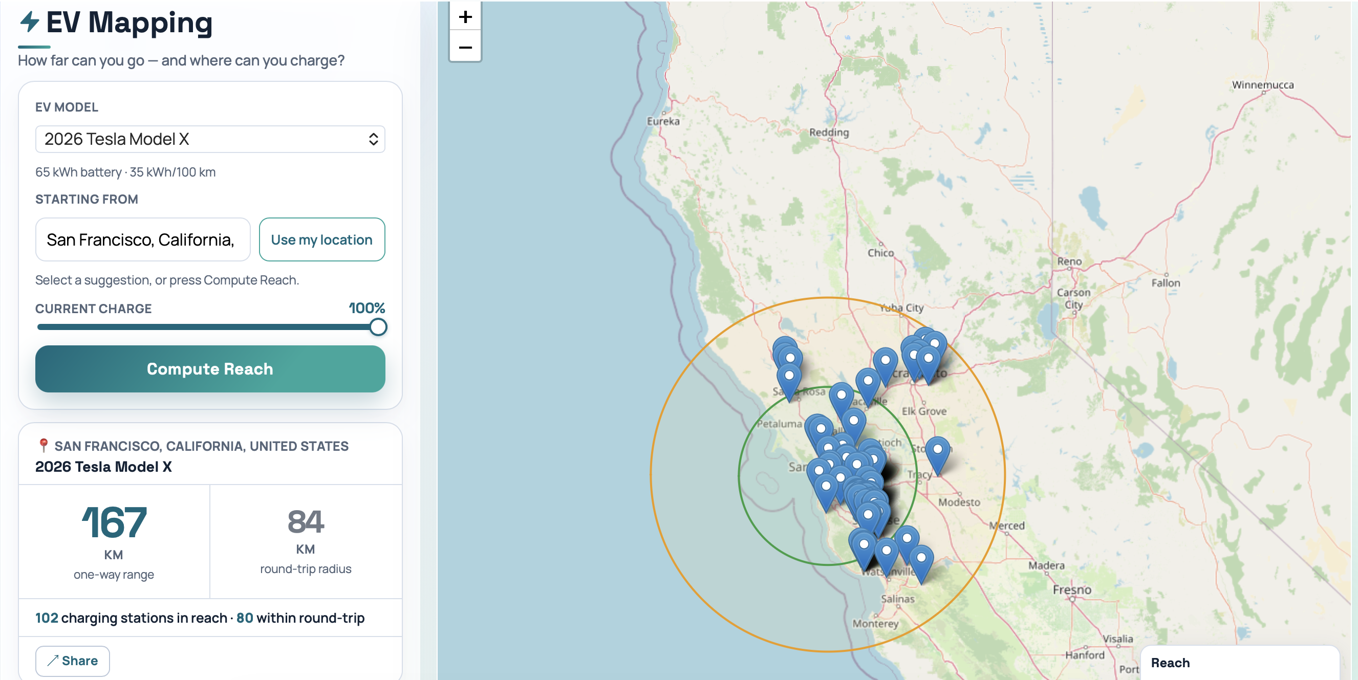
EV Mapping – Instant EV range and charger visualization on a live map
Summary: EV Mapping calculates one-way and round-trip electric vehicle ranges using over 700 car presets and displays them as circles on a live map with nearby chargers pinned. It integrates charger data from OpenChargeMap and OpenStreetMap, enabling navigation via Google Maps without login or installation.
What it does
Users select their EV model, charge level, and location to view range circles and charger locations on a map. Tapping a charger pin opens Google Maps for navigation. The app updates car data every 12 hours using a Python pipeline sourcing multiple government and regional databases.
Who it's for
EV drivers seeking accurate range estimates combined with charger locations for trip planning without requiring accounts or app installs.
Why it matters
It addresses uncertainty in EV trip planning by visually showing if a destination is reachable round-trip without charging, using real-world data and integrated charger mapping.