
ArchiKEK
Site analysis maps in seconds
ArchiKEK – Instant site analysis maps with layered exports
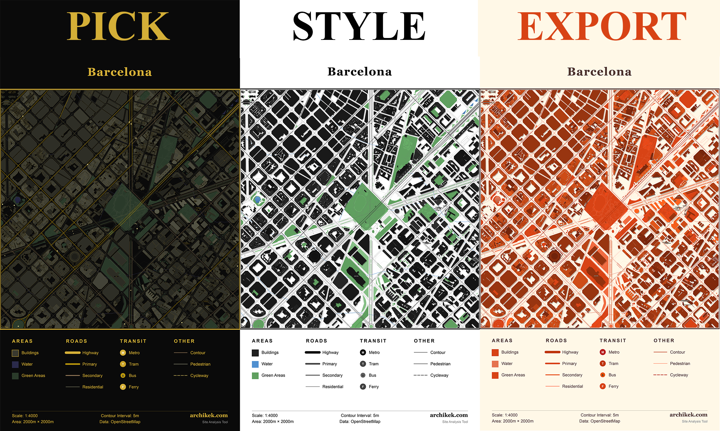
Summary: ArchiKEK generates figure-ground maps, Nolli diagrams, and urban analysis drawings in seconds by selecting any location and applying one of 24 themes. It exports layered SVG, DXF, and PNG files compatible with design software, streamlining map creation for architecture projects.
What it does
Users pick a location and style to produce print-ready, layered maps including transit stops, contours, landmarks, and building functions. Exports support Illustrator, AutoCAD, and Rhino workflows.
Who it's for
Architecture students and urban planners needing quick, detailed site analysis maps without complex GIS tools.
Why it matters
It reduces the time and effort required to create layered urban maps compared to traditional GIS and design software processes.