
Altis

Beautiful, real-time satellite tracking
#Space
#Science
#Design
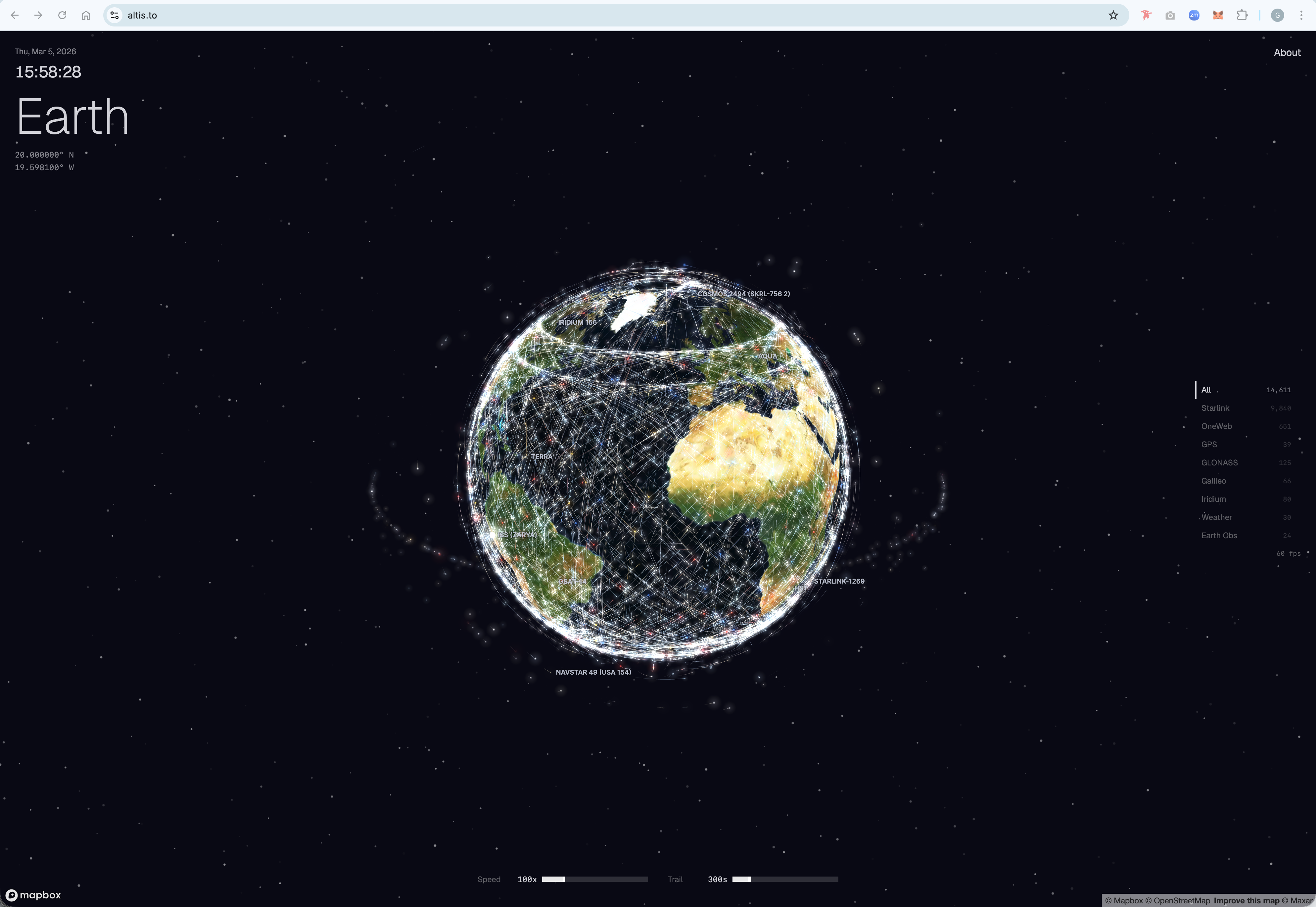
Altis – Real-time tracking of over 14,000 active satellites
Summary: Altis renders more than 14,000 active satellites in real time using Mapbox combined with a custom WebGL engine and shaders, enabling detailed and performant visualization including altitude data.
What it does
Altis visualizes satellite positions with high performance by integrating Mapbox and a custom WebGL engine, overcoming Mapbox's symbol limitations to display altitude information.
Who it's for
It is designed for users interested in exploring real-time satellite tracking with detailed spatial data.
Why it matters
Altis addresses the challenge of representing satellite altitude and position data more effectively than standard mapping tools.